
There Was Once an Asylum

This site not only provides an overview of mental health history and its implications for Goodna, but also explores the complex relationship between memory and history.
There are stories we may never know, but this site uncovers the history, revealing the layers of understanding that underpin the present.
It is done in a way that honours the patients, clients, and the people.


Early Road Network
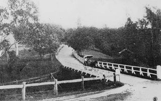
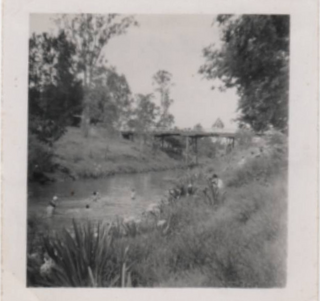
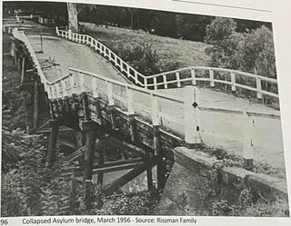
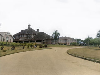
The roads and pathways are no less integral to the story of the development of the site than individual buildings. Most existing roads and pathways are significant for how the site functioned. Roadways are significant for their location and alignment. Material was quarried on site and laid by patient labour. The main driveway is of special significance. It was constructed in the l870s and partly realigned in 1913-6s and broadly followed the alignment of an earlier road. The new driveway was constructed to facilitate easier entry to the site and to serve as the principal entrance. A new bridge was constructed across Woogaroo Creek, and trees were planted on each side of the drive to form an avenue. The first bridge was timber with sandstone abutments and replaced a bridge that was further upstream. The new bridge created a shorter route from the train station from the site to Ipswich Road in a more direct line with the railway station. The bridge was 180 feet long and 19 feet in breadth and was built using recycled masonry from Old Men's 1 & 2, which was under demolition at the time. The bridge eventually collapsed in 1956. A study of vehicular and pedestrian circulation patterns was considered in the early 90s to determine the viability of re-establishing bridge access over Woogaroo Creek. This would enable the main point of address for the whole complex to be re-established. The existing access road to the north could then be limited to service access.
Boyce Road (by 1896) is now the main entrance to the site, running roughly east to west from near the Ipswich Motorway and connecting to Ellerton Drive. Ellerton Drive (c1870s, partly realigned 1913-6) is the connecting road running roughly south to north from the Female Patients Recreation Area to the Central Administration, Services, and Staff Residences Area. It has been partially removed at its southern end, where it historically crossed Woogaroo Creek on a sequence of bridges (a footbridge in the 1870s and a road bridge by 1896) that provided the main entrance to the site; however, this route remains open space. Hogg Lane (by 1896) and Barrett Drive (by 1986, and its extensions by 1932 and 1948)75 are secondary roads that separate the Central Administration and Services Area from the Male Patients Area and serve the rear of the male patient wards. Wolston Park Road runs roughly south to north, connecting the Central Administration Area to the northern parts of the site and was historically another main entrance to the site from the north. Only the southern section (by 1896) of this road is of state-level cultural heritage significance, comprising only the portion of the road running from Ellerton Drive to its intersection with Explorers Walk. The two long farm roads, Explorers Walk (south to north) and Aveyron Road (east to west), run from patient wards to the northern farm area.
Only the road routes are of state-level cultural heritage significance; none of their infrastructure or materials are.
The following road networks are of cultural heritage significance:
-
Boyce Road
-
Ellerton Drive
-
Hogg Lane
-
Barrett Drive
-
Wolston Park Road (Ellerton Drive to Explorers Walk)
-
Farm Roads
-
Explorers Walk
-
Aveyron Road
Local History: The day the bridge across Woogaroo Creek, Goodna, collapsed - with a car on it!
The bridge across Woogaroo Creek collapsed in about 1957 or 1958. One of the legends arising from the collapse has it that taxi driver Toby Rissman was driving over it at the time. After the collapse, the only access to the campus was via the level crossing at Wacol Station. A "temporary" detour was built about a mile or so down Brisbane Road. This detour ultimately morphed into Boyce Road, one of the main entrances to the hospital. It had been deemed uneconomical to replace the bridge, which is sad because we were deprived of the beautiful, tree-lined avenue from the bridge up the hill to the main Hospital.
Patrick Boyce
Photo Gallery 1
Photo Gallery 2
Take a Google Streetview tour


